The Inca Trail connects Cusco to Machu Picchu across 42 kilometers of rugged Andean terrain. Trekkers navigate cloud forests and alpine tundra to reach the 15th-century citadel.
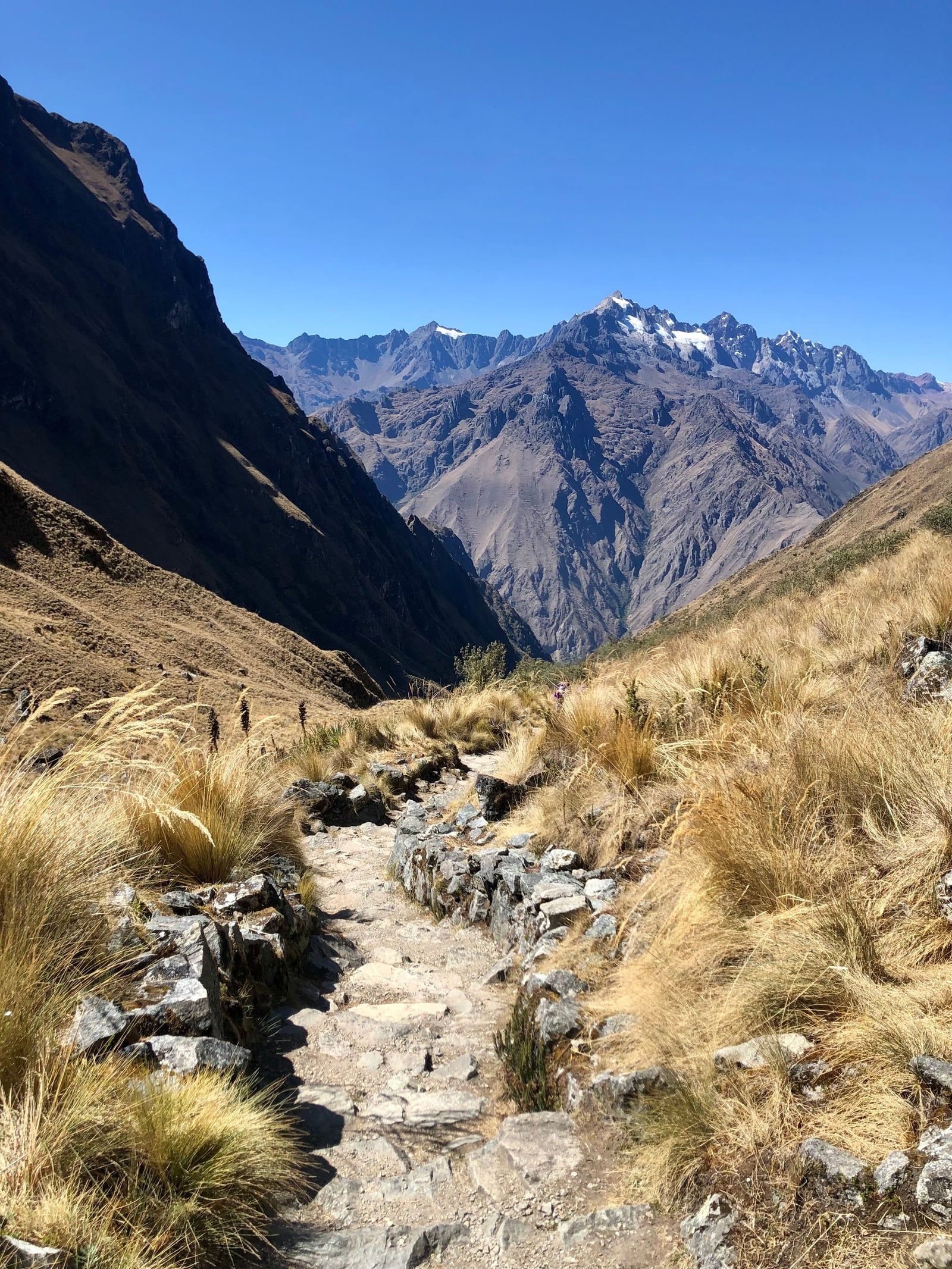
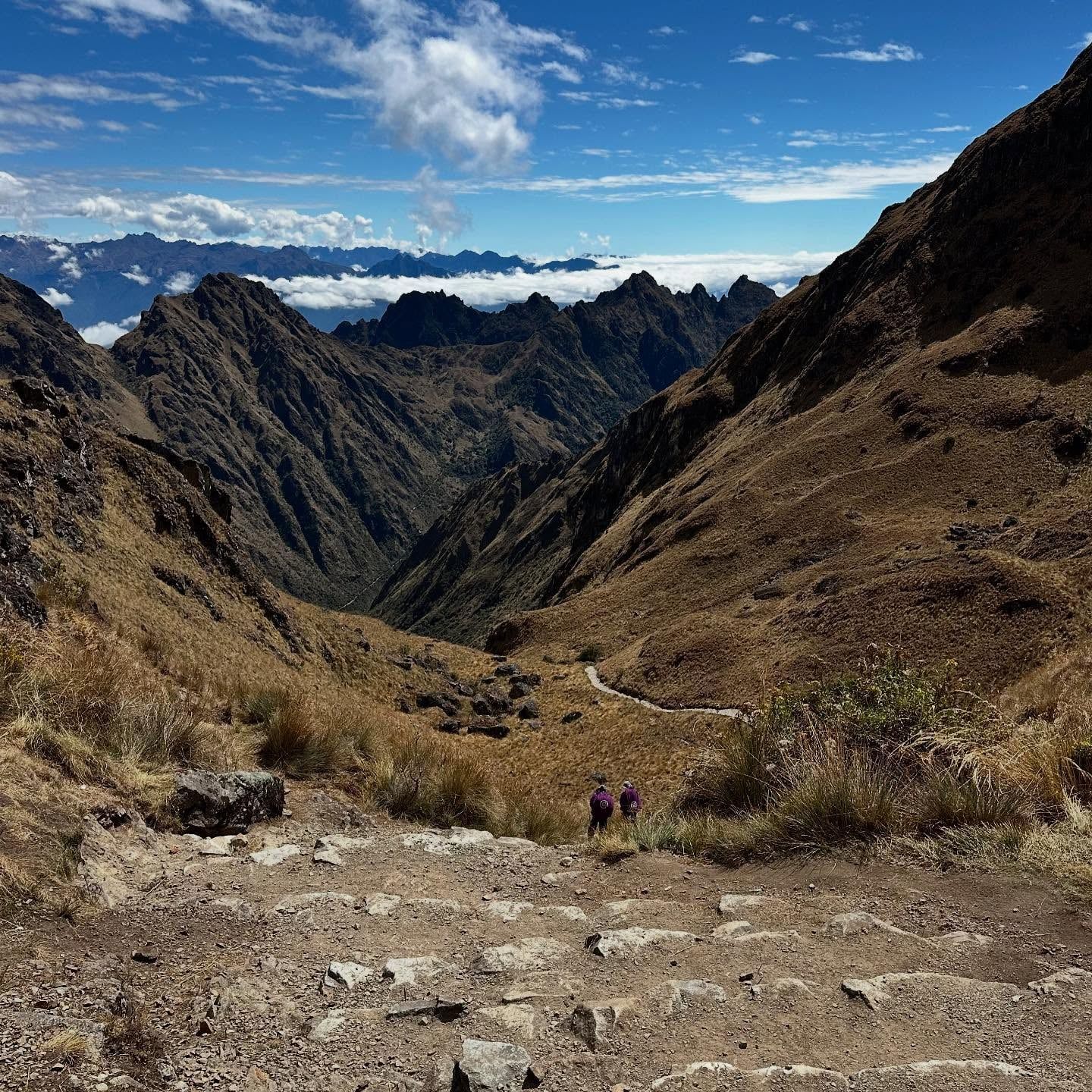
The Inca Trail spans 42 kilometers across the Peruvian Andes, linking the former imperial capital of Cusco to the stone citadel of Machu Picchu. Hikers spend four days crossing three overlapping routes—Mollepata, Classic, and One Day—navigating extreme elevation changes. The path forces a steep ascent to Warmi Wañusqa, or Dead Woman's Pass, at 4,215 meters. Oxygen levels drop significantly here. Altitude sickness frequently derails poorly acclimatized hikers, causing severe headaches and nausea. The route then descends through humid cloud forests and alpine tundra, terminating at the Inti Punku sun gate.
Pachacútec Yupanqui commissioned this mountain corridor in the mid-15th century. It functioned as a ceremonial pilgrimage rather than a simple trade route. The stone steps approach the Apus, the mountain spirits revered by the Inca. Today, the Peruvian government restricts access to 500 daily permits. Only 200 to 250 of these go to tourists. Licensed guides and porters claim the rest. February brings heavy rains and mandatory trail closures for conservation work. Landslides frequently block sections during the wet season from November to April. Trekkers must hire an authorized operator, as independent hiking has been illegal since 2001.
Pachacútec Yupanqui ordered the construction of the Inca Trail in the mid-1400s. The stone path provided ceremonial access to Machu Picchu, acting as a physical display of state power over the extreme Andean geography. Engineers carved steps directly into the granite cliffs and built retaining walls to prevent erosion. Huayna Capac later expanded this network, adding an estimated 16,000 kilometers of road across South America. His armies used these high-altitude corridors to mobilize troops and suppress regional rebellions. The route required constant maintenance. Local communities fulfilled their tax obligations, known as mit'a, by clearing landslides and repairing suspension bridges.
Spanish conquistadors arrived in the 1530s, bringing smallpox and superior weaponry. The Inca destroyed several paths leading to Machu Picchu to protect the citadel from discovery. Jungle vegetation quickly consumed the abandoned stone steps. The route remained largely forgotten by the outside world for nearly four centuries. Local farmers continued to use isolated sections to herd llamas and access terraced agricultural plots. Hiram Bingham's expeditions in 1911 brought international attention to the region. He focused primarily on the ruins rather than the pilgrimage paths connecting them.
Johan Reinhard and other explorers mapped the full extent of the trail during the 1980s. The Peruvian government recognized the economic potential and began restoring major portions in the 1990s. Unregulated tourism quickly degraded the fragile stonework. Authorities implemented strict regulations in 2001, banning independent hikers and requiring licensed guides. In 2014, UNESCO inscribed the entire Qhapaq Ñan network, including this 42-kilometer section, as a World Heritage Site. A 2022 law mandated a minimum wage of 650 Soles for porters working the four-day trek. Unethical agencies still attempt to bypass this requirement, paying as little as 350 Soles.
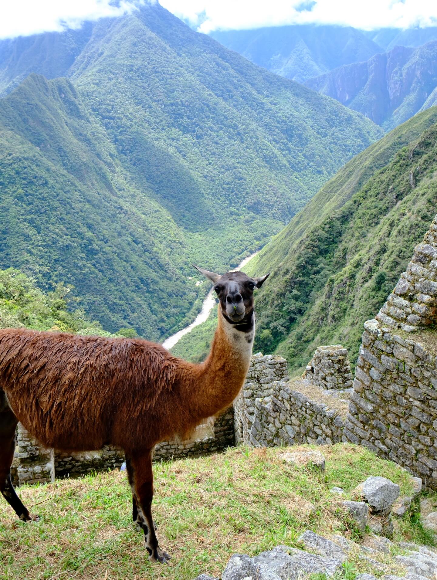
Engineers built the Inca Trail using dry stone masonry, fitting granite blocks together without mortar. The 42-kilometer route traverses four distinct ecological zones. Trekkers begin in the dry, scrubby terrain of the Urubamba Valley before climbing into alpine tundra. The path features thousands of original stone steps. Many are uneven and slick with moss. A brutal climb. Metal-tipped walking sticks fracture these ancient stones. Park rangers confiscate them at checkpoints, forcing hikers to rely on rubber-tipped poles or wooden staffs.
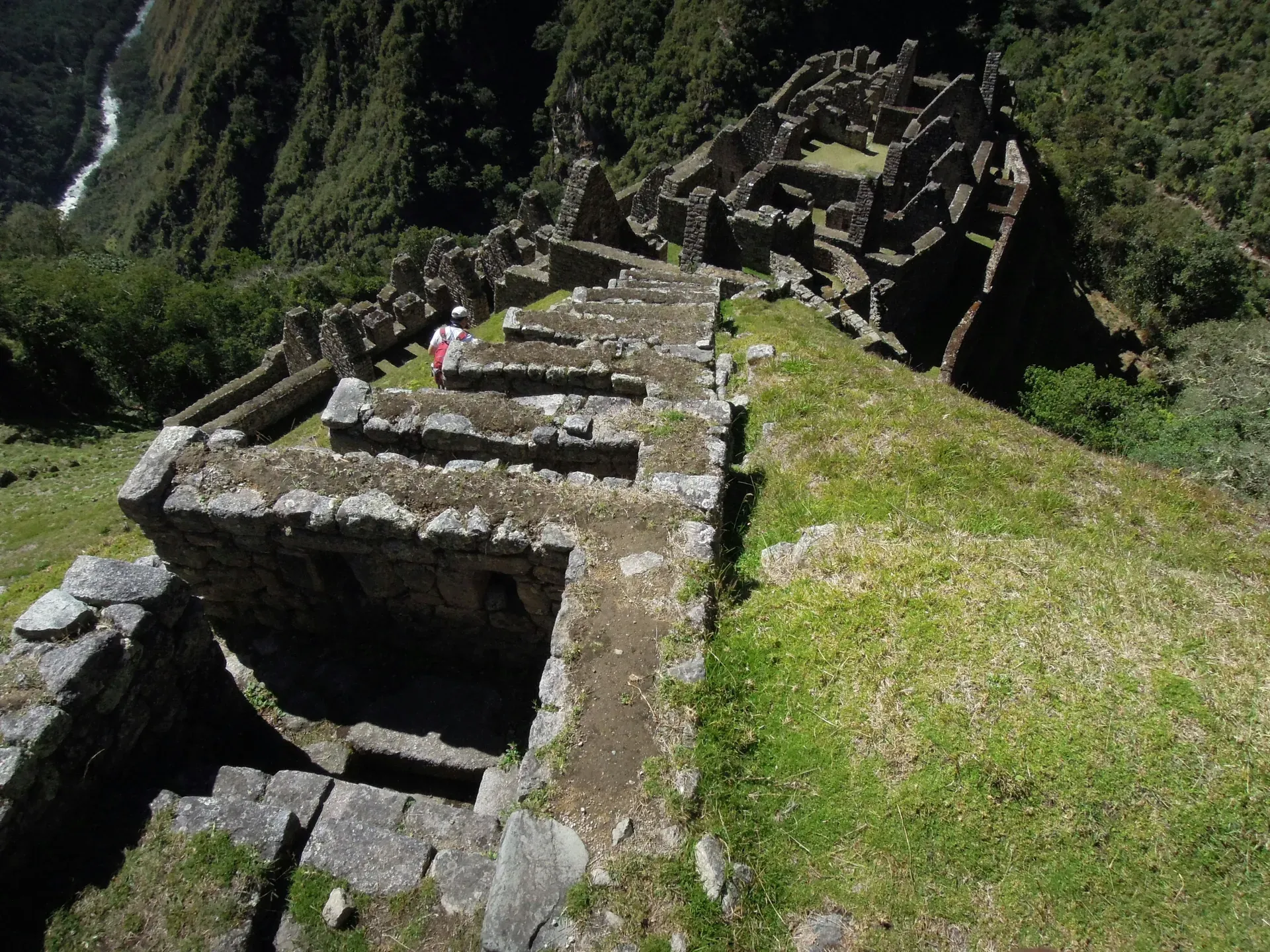
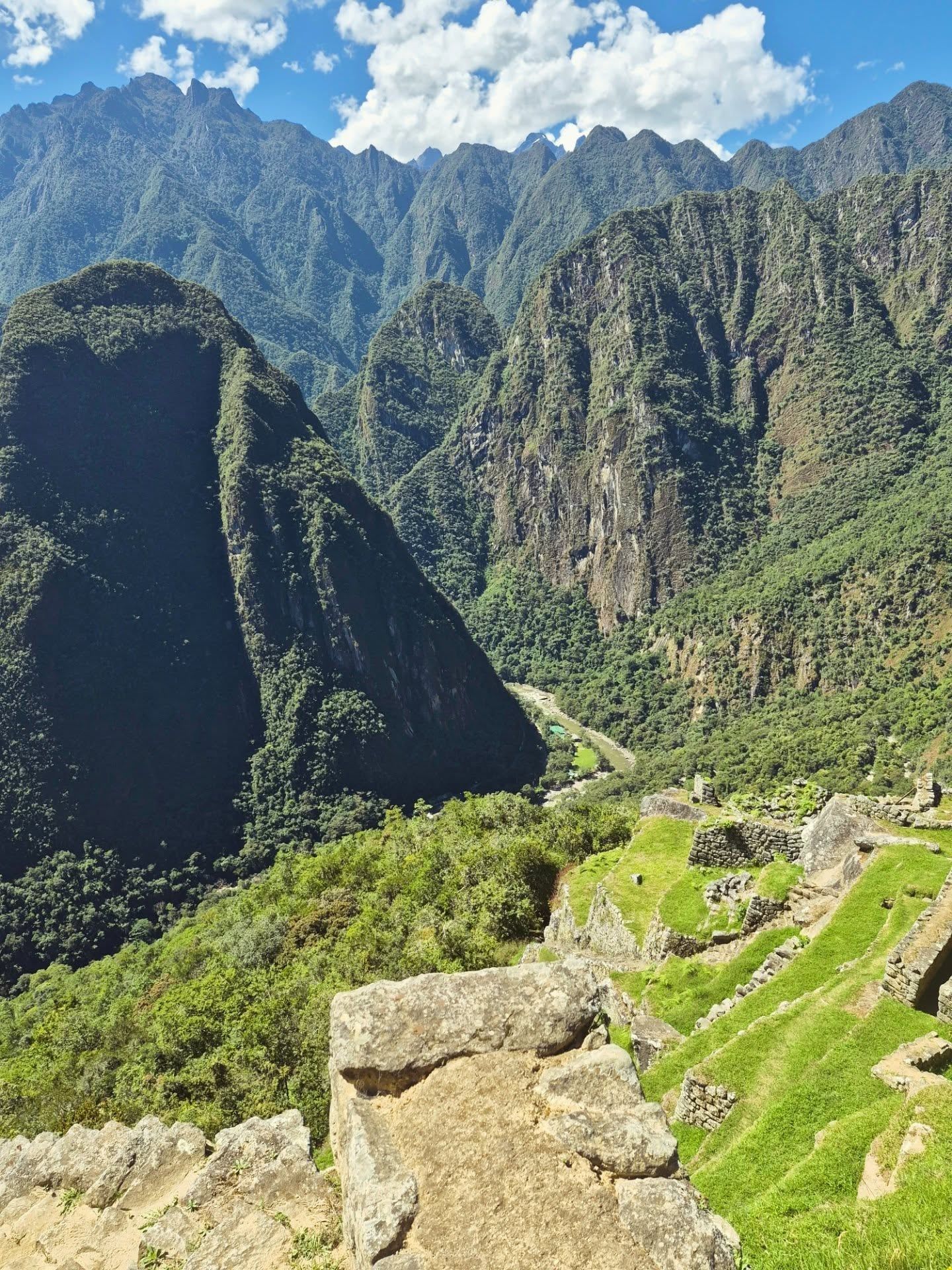
Warmi Wañusqa stands as the highest physical obstacle at 4,215 meters. The ascent involves a grueling, hours-long climb up steep staircases. Temperatures at the pass frequently drop below freezing. High winds batter hikers as they crest the ridge. Beyond the pass, the landscape shifts into dense cloud forest. Orchids and bromeliads cling to the trees, thriving in the constant humidity. The trail passes several major archaeological sites, including Wiñay Wayna. Here, agricultural terraces cascade down a near-vertical mountainside above the Urubamba River. Stone retaining walls absorb solar heat during the day, creating microclimates that allowed the Inca to grow crops at high altitudes. The final stretch narrows significantly before reaching Inti Punku. Hikers reach the Sun Gate to find the first complete view of Machu Picchu at 2,430 meters.
The Inca Trail functioned as a spiritual journey. Pilgrims walked this path to prepare themselves before entering the sacred precinct of Machu Picchu. The route physically aligns with key astronomical events and sacred peaks. The Inca worshipped the Apus, or mountain spirits. They believed these entities controlled the weather and crop yields. By building a road that forced travelers to ascend into the high peaks before descending to the citadel, the state reinforced the hierarchy between humans and the divine.
Sites along the trail served specific ritual purposes. Patallaqta, located near the beginning of the trek, housed soldiers and farmers who maintained the ceremonial road. Phuyupatamarka, the Town in the Clouds, features a series of ceremonial baths fed by natural springs. Priests likely used these water channels for purification rituals. Today, local Quechua porters maintain a deep connection to the landscape. Many chew coca leaves to ward off altitude sickness and offer prayers to the Apus before crossing treacherous passes. Disrespecting the mountains, such as shouting or leaving trash, is considered a severe offense against the local spirits. Rangers issue heavy fines for excessive noise or removing plants.
Only 200 to 250 tourists can hike the trail each day, with the remaining 250 permits going to guides and porters.
The entire trail network shuts down every February for heavy maintenance to repair bridges and clear landslides.
Specialized luxury tours use all-terrain wheelchairs and expert assistants to navigate the 2-day Royal Inca Trail.
Drones are completely banned on the trail and at Machu Picchu, and unauthorized use results in immediate confiscation.
A 2022 Peruvian law mandates a minimum wage of 650 Soles for porters completing the four-day trek.
The Peruvian government banned independent trekking in 2001, requiring all hikers to hire a certified guide.
Unlike most mountain climbs, the trail ends at a lower elevation (2,430 meters) than its highest pass (4,215 meters).
The Peruvian government strictly limits the Inca Trail to 500 permits per day. Out of these, only about 200 to 250 permits are allocated for tourists, while the remaining spots are reserved for licensed guides, cooks, and porters.
No, the Inca Trail is closed for the entire month of February for conservation and safety maintenance. During this time, teams reinforce stone structures, clear landslides, and repair bridges, though Machu Picchu itself remains open via train.
The Classic Inca Trail covers a total distance of 42 kilometers (26 miles). Trekkers typically complete this challenging mountain journey over a span of 4 days.
The highest point on the trek is Warmi Wañusqa, also known as Dead Woman's Pass, which sits at an elevation of 4,215 meters (13,829 feet). This pass requires a steep, physically demanding ascent that can cause altitude sickness.
No, it has been strictly mandatory since 2001 to hike the Inca Trail with a certified guide and an authorized tour operator. Independent trekking is completely prohibited, and rangers check official permits and passports at trail checkpoints.
A standard 4-day Classic Inca Trail tour ranges from €665 (approximately $700-$800 USD) to over $1,300 per person. This price typically includes trail permits, Machu Picchu entry, professional guides, porters, camping gear, and meals.
Travelers can opt for the Short Inca Trail, which takes 2 days and 1 night to complete. This route covers a distance of 12 kilometers (9 miles) over roughly seven hours of hiking, ending with a hotel night in Aguas Calientes.
Drones are completely banned on the trail and at Machu Picchu, and unauthorized use will result in confiscation. Tripods and monopods are also prohibited without a professional permit, though small flexible-leg phone grips are generally tolerated.
For popular dry-season months from May to August, you must book your permits 6 to 9 months in advance. For other months, booking 3 to 4 months ahead is recommended as permits sell out rapidly.
A Peruvian law passed in 2022 mandates that porters must receive a legal wage of 650 Soles (about $176 USD) for the 4-day trek. Unethical agencies occasionally fight this law and pay as little as 350 Soles.
Browse verified tours with free cancellation and instant confirmation.
Find Tours